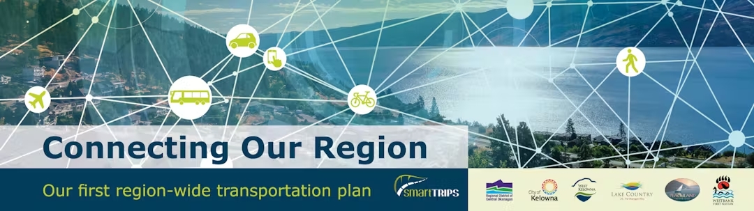
The Regional Transportation Plan identifies transportation projects and priorities that will help build and maintain a healthy, thriving and connected future for the Central Okanagan region. It will help create a region where more people can choose sustainable and affordable transportation options.

The interconnected projects, programs, and policy recommendations will work together to:

  • connect people and places across the region,
  • prepare for future population growth and technology innovations,
  • help people of all ages and abilities get around,
  • reduce future greenhouse gas emissions, and
  • help economic recovery post-pandemic.


The Regional Transportation Plan is a project of the Sustainable Transportation Partnership of the Central Okanagan (STPCO), a collaboration of the City of Kelowna, City of West Kelowna, District of Lake Country, District of Peachland, Westbank First Nation, and the Regional District of Central Okanagan. The STPCO is focused on environmentally responsible/sustainable transportation solutions that strengthen the economy and quality of life in the region.

Updates

How do you typically travel within the Central Okanagan? Select all that apply. Required
Location of your workplace(s) (select all that apply) Required
Engagement feedback Required
Yes
No
Somewhat
Was the information presented clear and understandable?
Do you understand how public input is being used throughout this process?
Did you feel that participating was a valuable experience?
Based on your previous knowledge about the Regional Transportation Plan, has your knowledge and understanding of this project improved?
Overall, how well do you think the Regional Transportation Plan achieves the following outcomes? Required
Well
Neutral
Not well
Not sure
Move people and goods more efficiently
Achieve fast and reliable transit
Create a safe and convenient region-wide bike and trail network
Incorporate new mobility options and plan for future technology changes
Age Required


Tell us about yourself


Next steps


Region-wide partnership and collaboration


Overall direction


Incorporate new mobility options & prepare for future technology change


Create a safe and convenient region-wide bike and trail network


Achieve fast and reliable transit

Enter the prize draw


Move people and goods more efficiently

Background

The survey form is now closed. Thanks for your contributions.

Select your preferred Zoom panel date Required

Please provide the following information

The survey form is now closed. Thanks for your contributions.

Westside Example Options
Note: the Ministry of Transportation and Infrastructure is currently studying the Highway 97 / Boucherie Road intersection, as well as other highway improvements.
Connecting Across the Lake Example Options
Note: The Ministry of Transportation and Infrastructure's (MoTI) Central Okanagan Planning Study (COPS) project showed that there is sufficient capacity to meet traffic demand on the bridge until at least 2040. The Regional Transportation Plan (RTP) is considering options to support travel across the lake, but a second crossing is not within the scope of the plan. MoTI will coordinate with the RTP during the upcoming, final phase of COPS.
City of Kelowna (western side) Example Options
City of Kelowna (Western Side) Map
Kelowna (Eastern Side) Example Options
Kelowna (Eastern Side) Map
Gateway Example Options
Gateway Map
Lake Country Example Options
Note: the Ministry of Transportation and Infrastructure has initiated a separate study to evaluate the Glenmore / Beaver Lake Road intersection and Highway 97 in the immediate area.
Peachland Example Options
Note: the Ministry of Transportation and Infrastructure is currently studying Highway 97 in Peachland and is considering various options, both on the existing corridor and as a bypass of the community.
How supportive are you of the potential solutions listed below that aim to improve regional travel by transit? Required
Very supportive
Somewhat supportive
Not supportive
Not sure
More frequent transit service (i.e. bus comes more often)
Higher order transit (i.e. full or partial separation from auto traffic; could be bus or possibly rail)
Park and ride (i.e. parking lot at transit stations so people can drive to/from the transit stop and home)
Mobility hubs (e.g. carshare or bikeshare to help people get to/from transit stops)
Integrated fare payment (i.e. one fee, multiple travel modes)
Integrated trip planning (i.e. one app, multiple modes)
Better route information or real-time information
More comfortable stops / stations (e.g. bus shelters, benches, etc)
Increased transit service hours (i.e. bus runs earlier and/or later)
Transit priority improvements (i.e. bus gets green light and/or can bypass auto traffic at intersections)
How supportive are you of the following potential solutions that aim to improve regional travel by walking or biking? Note: Improvements for pedestrians consider the needs of people of all ages and abilities. Required
Very supportive
Somewhat supportive
Not supportive
Not sure
Separated bikeways (e.g. cycle tracks or multi-use paths that are separate from auto traffic)
Regional bike share / electric bike share
Better options to get people to/from major transit stops
Connected networks (i.e. fill in gaps in regional bicycle, pedestrian and trail networks)
Better trip-end facilities (e.g. safe bike parking, lockers and showers at regional destinations, etc)
More enjoyable streetscapes and environments for walking (i.e. tree lined streets, boulevards, street lighting)
Regional shared mobility options (e.g. bikeshare, e-bike share, e-scooter share, etc)
Multi-modal connectivity (e.g. better bike and pedestrian access to transit stops)
Safe routes to school programs (e.g. make it easier for kids to bike, walk or take the bus to school)
While providing convenient regional connections by transit, biking and walking are important, many regional trips will still need to be made by vehicle, whether for goods movement, emergency /evacuation purposes or private travel. How supportive are you o Required
Very supportive
Somewhat supportive
Not supportive
Not sure
Carshare programs (e.g. Modo, Car2Go)
Ride-hailing programs (e.g. Uber, Lyft)
Building out the network (i.e. more roads/routes to choose from)
Managed lanes (e.g. HOV lanes, express lanes, etc)
Highway express lanes – generally a dedicated lane in each direction that allow longer distance trips to bypass some intersections
Reversible / contraflow lanes (i.e. lanes that are reversed to allow for additional capacity during peak periods)
Pricing strategies (e.g. parking fees, fees to travel during congested times, etc)
Adding capacity focusing on congested locations (e.g. widening roads, expanding intersections)
How supportive are you of the ideas above for improving regional travel connections to the Westside? Required
Very supportive
Somewhat supportive
Not supportive
Not sure
A - Highway 97 Dedicated Transit Lanes (purple on map)
B - Stevens Road Capacity Expansion (blue on map)
C - Shannon Lake Road Transit Enhancements (teal on map)
D - Westside Trail (orange on map)
How supportive are you of the ideas above for improving regional travel connections across the lake? Required
Very supportive
Somewhat supportive
Not supportive
Not sure
Reversible contra-flow lane
Reversible contra-flow lane: dedicated to transit
New dedicated shoulder transit lane
Very high frequency bus across lake combined with first/last mile options
Water taxi / ferry
How supportive are you of the ideas above for improving regional travel connections to the western side of Kelowna? Required
Very supportive
Somewhat supportive
Not supportive
Not sure
A - Highway 97 Dedicated Transit Lanes (purple on map)
B - Central Okanagan Multi-Modal Corridor (COMC) (blue on map)
D - Clement Avenue Transit Priority or Dedicated Transitway (orange on map)
E - Richter and/or Pandosy Transit Enhancement (light green on map)
F - Ethel Street Active Transportation Corridor Extension (pink on map)
How supportive are you of the ideas above for improving regional travel connections to the eastern side of Kelowna? Required
Very supportive
Somewhat supportive
Not supportive
Not sure
A - Highway 33 / Rutland Road Transit Priority (purple on map)
B - Highway 97 Dedicated Transit Lanes (blue on map)
C - Hollywood Road Extension and Transit Priority (teal on map)
D - Central Okanagan Multi-Modal Corridor (COMC) (orange on map)
E - Glenmore Road improvements for All Modes (light green on map)
How supportive are you of the ideas above for improving regional travel connections to and within the Okanagan Gateway area? Required
Very supportive
Somewhat supportive
Not supportive
Not sure
A – Acland-Bulman Connection (purple on map)
B – Improved Highway 97 / Airport Access (blue on map)
C – Shared-use of the Former Rail Corridor (teal on map)
D – RapidBus Extension to the Airport (orange on map)
E – Internal Gateway Connectivity (light green on map)
How supportive are you of the ideas above for improving regional travel connections to Lake Country and beyond? Required
Very supportive
Somewhat supportive
Not supportive
Not sure
A – Jim Bailey Industrial Park Connection (purple on map)
B - Expanded Transit Service to Lake Country and Beyond (blue on map)
C – Glenmore Road Upgrades and Active Transportation (teal on map)
Land use and development patterns can determine how far we need to travel and the convenience of various travel modes for reaching destinations. How supportive are you of the following potential solutions that aim to improve regional travel using land us Required
Very supportive
Somewhat supportive
Not supportive
Not sure
Satellite health care, education, and civic services in each community
Policies that restrict sprawl
Building new residential development near existing employment, services and amenities
Transit-oriented development (e.g. placing new development near existing transit corridors and hubs)
Regional development assessments (e.g. assessing impacts on regional travel when a new development is proposed)
How supportive are you of the ideas above for improving regional travel connections to Peachland and beyond? Required
Very supportive
Somewhat supportive
Not supportive
Not sure
A - Transit / Mobility Hub (purple on map)
B - Transit Connections North and South (blue on map)
C - Westside Trail (teal on map)
Survey Feedback Required
Yes
No
Don't know
Was the information presented clear and understandable?
Do you understand how public input will be used in this process?
Did you feel that participating was a valuable experience for you?
Did you have the opportunity to share your views?
Did you learn something new?
"Travel Demand Management" refers to programs or policies that reduce the need to travel by single-occupancy vehicle during congested times of day. How supportive are you of the following Travel Demand Management strategies? Required
Very supportive
Somewhat supportive
Not supportive
Not sure
Employee commute programs (e.g. discounted transit passes, carpool incentives, bike parking, lockers, showers, etc.)
Telecommuting (e.g. allowing people to work from home)
Parking policies to encourage sustainable transportation modes
Offset work hours (i.e. start earlier or later)
Community partnerships with major employers and schools to explore creative mobility solutions
Partnerships with major employers and schools to explore creative mobility solutions
Did you attend the Connecting our Region: Let's Talk Transportation event on April 24 at UBC Okanagan? Required
Do you want to provide input on ideas for connecting Peachland and beyond? Required
Do you want to provide input on ideas for connecting the Westside? Required
Do you want to provide input on ideas for connecting across the lake? Required
Do you want to provide input on ideas for connecting the City of Kelowna (western side)? Required
Do you want to provide input on ideas for connecting the City of Kelowna (eastern side)? Required
Do you want to provide input on ideas for connecting the Okanagan Gateway area? Required
Do you want to provide input on ideas for connecting Lake Country and Beyond? Required
SECTION 1: OPTIONS FOR CONNECTING OUR REGION
TRANSIT
ACTIVE TRANSPORTATION
VEHICLE EFFICIENCY
LAND USE AND DEVELOPMENT
TRIP REDUCTION AND ELIMINATION
SECTION 2: WHAT ARE YOUR IDEAS FOR THE FOLLOWING AREAS?
CONNECTING PEACHLAND AND BEYOND
CONNECTING THE WESTSIDE
CONNECTING ACROSS THE LAKE
SECTION 3: ABOUT YOU
CONNECTING THE CITY OF KELOWNA (WESTERN SIDE)
CONNECTING THE CITY OF KELOWNA (EASTERN SIDE)
CONNECTING THE OKANAGAN GATEWAY
CONNECTING LAKE COUNTRY AND BEYOND

The survey form is now closed. Thanks for your contributions.

How do you typically travel within the Central Okanagan? Select all that apply. Required
Location/s of your workplace Required
Engagement feedback Required
Yes
No
Somewhat
Somewhat disagree
Definitely disagree
Was the information presented clear and understandable?
Do you understand how public input is being used throughout this process?
Did you feel that participating was a valuable experience?
Statement 4
Based on your previous knowledge about the Regional Transportation Plan, has your knowledge and understanding of this project improved?
Overall, how well do you think the Regional Transportation Plan achieves the following outcomes? Required
Well
Neutral
Not well
Not sure
Not well
Somewhat not effectively
Not at all effectively
Move people and goods more efficiently
Achieve fast and reliable transit
Improve local connections to regional transit
Create a safe and convenient region-wide bike and trail network
Incorporate new mobility options and plan for future technology changes
Reduce future greenhouse emissions by providing more options for sustainable, low-carbon transportation modes
Age Required


Tell us about yourself


Next steps

Background


Region-wide partnership and collaboration


Move people and goods more efficiently


Achieve fast and reliable transit


Create a safe and convenient region-wide bike and trail network


Incorporate new mobility options & prepare for future technology change


Overall direction

Enter the prize draw

The survey form is now closed. Thanks for your contributions.

Provide a short summary of your question.

You have 150 characters left

Provide detailed information relating to your question.

You have 500 characters left

Select a respondent from the list that you would most like to answer your question.

Moderation Policy

These are the people that are listening and responding to your questions.

Respondent 1

Respondent 2

{{ question.title }}

{{ question.username }} asked

{{question.description}}

{{ answer.respondent.name }}
| Edited

Answer this question

Select the respondent who will be marked as answering the question

Provide the answer to the question. Answer can be saved as draft and published when complete.

No questions found