Commonwealth Road – Jim Bailey Road Connection

The City is working closely with Okanagan Indian Band (OKIB) Members, Locatees and community members to develop a preliminary design for Commonwealth Road. This work is the first step towards connecting Commonwealth Road and Jim Bailey Road.

Share your feedback

  • Take the online survey and add a marker to the interactive map by Sunday, February 23, 2025
  • Attend the public open house
    • Date: Thursday, February 6, 2025
    • Time: 4 to 7 p.m.
    • Location: Lake Country Fire Hall (11063 Okanagan Centre Rd. E, Lake Country)

Project background

The purpose of the preliminary design is to understand how to improve Commonwealth Road and make it suitable for all users once it’s connected to Jim Bailey Road. This will provide a strong foundation for more detailed design work and future construction.

Project area

The project area is shown in blue in the photo below:

Map of Commonwealth Road, with the project area from Middle Vernon Creek to Jim Bailey Road highlighted.

Project benefits

  • Having a second road to access the area will improve emergency access and reduce congestion on Beaver Lake Rd
  • New sidewalks, bicycle infrastructure, pedestrian crossings and street trees on Commonwealth Road
  • Water and sewer services in the Road, with hydrants, will enable connections to existing and future properties
  • Enable development opportunities in the area
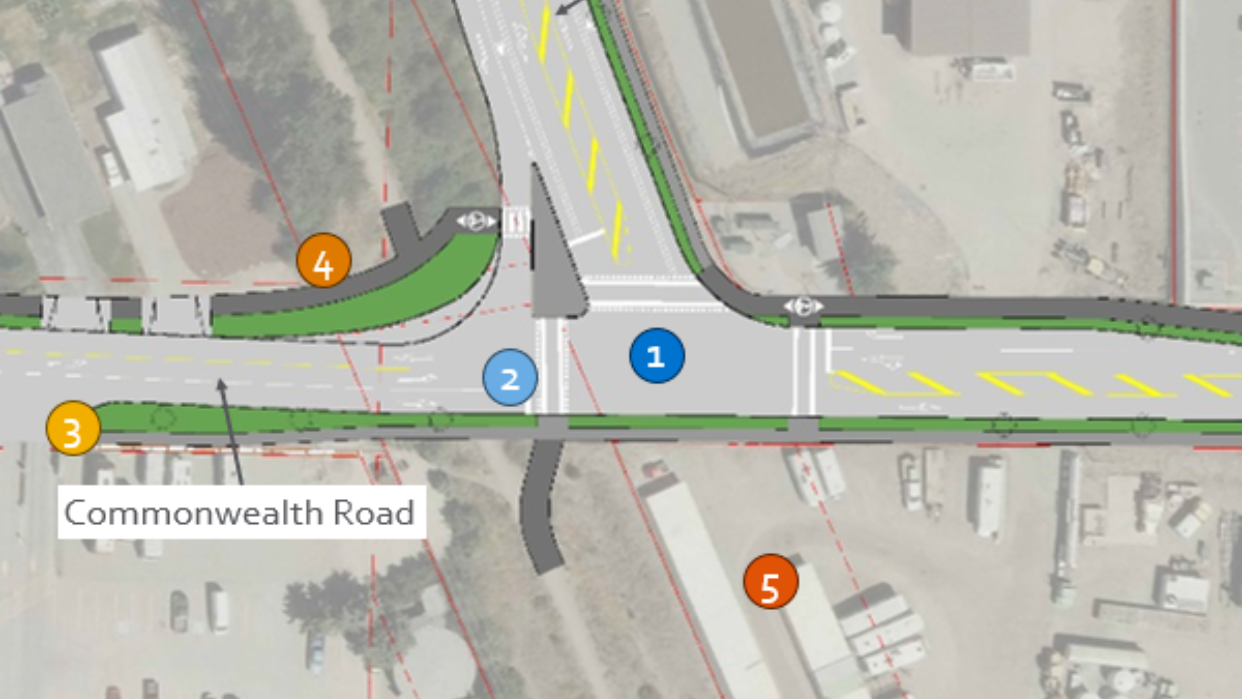
Preliminary Design

Click image to enlarge

Commonwealth Road

Features

  1. Multi-use path on the north side of the road for walking and biking
  2. Sidewalk on the south side of the road
  3. A treed boulevard separates the multi-use path and sidewalk from traffic
  4. Noise wall on the south side where it will reduce traffic noise for residents
  5. Left-turn lanes at property access roads where possible

Why this design?

  • Fits within the City's property lines
  • The multi-use path on the north side is easy for Meadowbrook Estate residents to access, and connects to the Rail Trail and a future pedestrian and cyclist crossing over Middle Vernon Creek
  • Separating the multi-use path from the road increases safety for cyclists and pedestrians
  • The narrow roadway accommodates trucks while encouraging slower traffic speeds
  • Inclusion of trees and noise protection

Click image to enlarge

Commonwealth Road – Jim Bailey Intersection

Features

  1. Traffic signal
  2. Safe pedestrian and cyclist crossings are aligned with the Rail Trail
  3. Noise wall
  4. Sidewalk
  5. Multi-use path
  6. Ability to add a road to the south of the intersection in the future

Why this design?

  • Accommodates projected traffic volumes in the future
  • Boulevards and crossings make it safer and more comfortable to walk or bike
  • Supports development within OKIB and Jim Bailey industrial lands

Share your input

Interactive map

On the map of Commonwealth Road below, click the add marker button to make a comment about that location or feature and let us know what you think should be changed or improved. Add as many markers as you would like.